


Divide 02-02 Voting District, Divide County, North Dakota
About
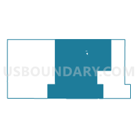
Outline

Summary
| Unique Area Identifier | 642045 |
| Name | Divide 02-02 Voting District |
| County | Divide County |
| State | North Dakota |
| Area (square miles) | 567.97 |
| Land Area (square miles) | 555.41 |
| Water Area (square miles) | 12.56 |
| % of Land Area | 97.79 |
| % of Water Area | 2.21 |
| Latitude of the Internal Point | 48.81827400 |
| Longtitude of the Internal Point | -103.36671070 |
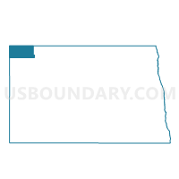
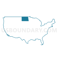
Maps
Graphs
Select a template below for downloading or customizing gragh for Divide 02-02 Voting District, Divide County, North Dakota


Neighbors
Neighoring Voting District (by Name) Neighboring Voting District on the Map
- Divide 02-01 Voting District, Divide County, ND
- Divide 02-03 Voting District, Divide County, ND
- Divide 02-04 Voting District, Divide County, ND
- Williams 2-65 Voting District, Williams County, ND
- Williams 2-67 Voting District, Williams County, ND
Top 10 Neighboring County Subdivision (by Population) Neighboring County Subdivision on the Map
- Crosby city, Divide County, ND (1,070)
- Wildrose city, Williams County, ND (110)
- Blooming Prairie township, Divide County, ND (50)
- Blooming Valley township, Divide County, ND (47)
- Troy township, Divide County, ND (45)
- Long Creek township, Divide County, ND (37)
- Scorio township, Williams County, ND (37)
- Blue Ridge township, Williams County, ND (35)
- Fillmore township, Divide County, ND (35)
- Coalfield township, Divide County, ND (34)
Top 10 Neighboring Place (by Population) Neighboring Place on the Map
Top 10 Neighboring Unified School District (by Population) Neighboring Unified School District on the Map
- Divide County Public School District 1, ND (1,927)
- Nesson Public School District 2, ND (1,236)
- Grenora Public School District 99, ND (652)
Top 10 Neighboring State Legislative District Lower Chamber (by Population) Neighboring State Legislative District Lower Chamber on the Map
Top 10 Neighboring State Legislative District Upper Chamber (by Population) Neighboring State Legislative District Upper Chamber on the Map
Top 10 Neighboring 111th Congressional District (by Population) Neighboring 111th Congressional District on the Map
Top 10 Neighboring Census Tract (by Population) Neighboring Census Tract on the Map
- Census Tract 9545, Divide County, ND (2,071)
- Census Tract 9534, Williams County, ND (1,934)
- Census Tract 9535, Williams County, ND (1,676)
Top 10 Neighboring 5-Digit ZIP Code Tabulation Area (by Population) Neighboring 5-Digit ZIP Code Tabulation Area on the Map
- 58730, ND (1,295)
- 58765, ND (248)
- 58830, ND (213)
- 58795, ND (198)
- 58844, ND (142)
- 58856, ND (131)
- 58833, ND (80)